|
Nullarbor
Plain Outback
Western Australia WA
The
Eyre
Highway
is
one
of
Australia's
greatest
road
journeys.
It
is
named
after
the
explorer,
Edward
John
Eyre,
who
in
1841
barely
survived
thirst,
hunger
and
treachery
by
guides
to
make
the
first
East-West
crossing
of
the
continent.
The
entire
length
of
the
highway
is
bitumen
and
is
extremely
well
signposted,
with
indications
of
the
distance
to
the
next
town
with
petrol
and
other
services.
The
Western
Australian
section
of
the
Highway
begins
at
Border
Village,
which
has
a
celebrated
signpost
giving
directions
to
Paris,
the
South
Pole
and
other
rather
improbable
destinations.
A
further
12km
west,
is
the
town
of
Eucla.
Eucla
was
established
as
a
telegraph
station
in
1877
as
part
of
the
link
between
East
and
West.
Once
it
was
one
of
the
busiest,
yet
loneliest,
stations
in
Australia.
The
modern
township
was
located
on
the
Hampton
Escarpment
after
the
original
buildings
were
swallowed by
sand
dunes.
At
night
an
illuminated
cross
dedicated
to
all
Eyre
Highway
travellers
looks
down
onto
the
ruins
of
old
Eucla
from
the
escarpment
above.
Travelling
from
Eucla
the
road
passes
through
Mundrabilla
then
onto
Madura.
It
is
here
that
the
Highway
again
climbs
to
the
Escarpment
allowing
a
magnificent
view
and
then
continues
to
Cocklebiddy.
In
1984,
a
world
diving
record
was
set
at
Cocklebiddy
Cave,
12
kilometres
north
of
the
Highway
on
an
accessible
road.
Also
of
interest
in
the
area
is
the
Eyre
Bird
Observatory
(four-wheel
drive
vehicles
only).
Between
Caiguna
and
Balladonia
travel
along
one
of
the
longest
straight
stretches
of
road
in
the
world,
145km.
East
of
Balladonia
Hotel
and
Service
Station,
visit
the
Balladonia
Station
Homestead
and
see
a
gallery
of
oil
paintings
depicting
the
history
of
Balladonia
and
the Eyre
Highway.
Tours
can
be
arranged
between
9.00am
and
4.30pm
daily
(WA
time).
Tel
(090)
393
456.
After
Balladonia
and
its
century
old
stone
fences,
the
Highway
traverses
the
hilly
and
undulating
country
surrounding
the
Fraser
Range.
From
there
it
is
only
a
short
drive
to
Norseman,
where
the
Eyre
Highway
terminates.
From the South Australian side, the
trip
begins
properly
at
Port
Augusta,
330km
north-east
of
Adelaide
at
the
head
of
Spencer
Gulf,
a
provincial
city
that
services
a
vast
area
of
semi-arid
grazing
and
wheat
growing
country.
The
Highway
meets
the
sea
at
Ceduna,
a
small
modern
town
on
picturesque
Murat
Bay.
On
the
outskirts
of
Ceduna
is
a
warning
sign
about
the
last
reliable
water.
This
marks
the
end
of
cultivated
country
and
the
beginning
of
the
deserted,
almost
treeless
land that
creeps
towards
the
Nullarbor
Plain.
The
highway
stays
close
to
the
coast
and
there
is
always
a
little
scrub
and
other
vegetation
on
the
plains
or
on
the
sand
dunes
that
lie
between
the
Highway
and
the
ocean.
The
name
'Nullarbor'
derives
its
name
from
Latin
for
'no
trees'
and
the
name
is
more
than
apt.
The
Eyre
Highway
crosses
only
a
small
section
of
true
treeless
plain.
West
of
Ceduna
is
Penong,
a
town
of
100
windmills,
and
breathtaking
coastal
beauty.
Then on
to
Nundroo
and
south
to
the
abandoned
settlement
of
Fowlers
Bay,
once
an
exploration
depot
for
Edward
John
Eyre
and
now
a
charming
ghost
town
best
known
for
its
fishing.
At
the
Yalata
Aboriginal
Community,
there
are
genuine
artefacts
for
sale.
Between
Nullarbor
and
Border
Village
are
five
of
the
most
spectacular
coastal
lookouts
anywhere
on
the
Australian
coastline,
where
giant
ocean
swells
pound
the
towering
limestone
cliffs
that
make
up
this
part
of
the
Great
Australian
Bight.
From
June
to
October,
an
added
bonus is
the
chance
of
spotting
the
majestic
Southern
Right
Whale
on
its
annual
migration
along
the
southern
part
of
the
continent.
If
planning
a
return
journey,
you
may
like
to
consider
driving
one
way
and
placing
the
car
on
the
train
for
the
return trip, as many others do.
Important
Reminder
- There
are
limited
Eftpos
banking
facilities.
- There
are
limited
fresh
water
supplies
between
Norseman
and
Ceduna.
- Be
sure
to
take
on
sufficient
water
for
your
journey.
- There
are
quarantine
checkpoints
at
Norseman
for
Westbound
travellers
and
Ceduna
for
Eastbound
travellers.
Prohibited
or
restricted
items
include
potatoes,
onions,
fruit,
walnuts,
bird
seed,
other
seed,
plants,
soil,
animal
skins
and
wool,
livestock,
grain,
fodder,
used
fruit
containers,
used
potato
sacks,
birds,
rabbits,
native
fauna
and
honey.
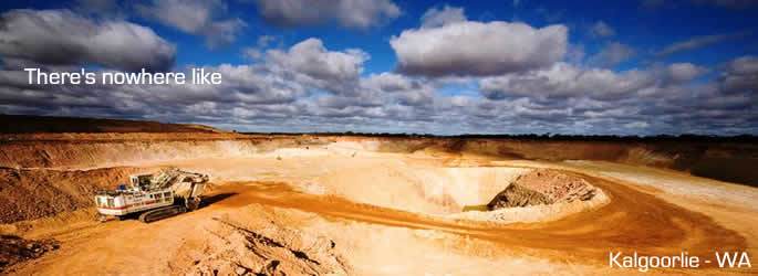
All Photos courtesy of Tourism Western Australia
|